
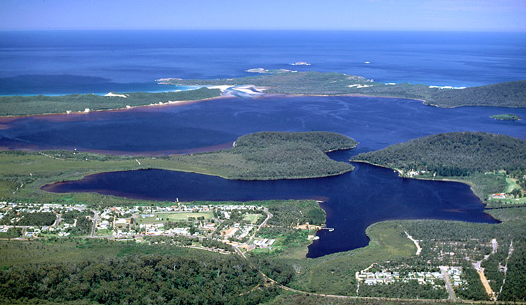
A birdseye view of Walpole township, Walpole Inlet, Nornalup Inlet, and the Southern Ocean.
Walpole is the gateway to the Walpole Wilderness, a group of conservation reserves featuring vast tracts of jarrah, tingle and karri old-growth forests, including the majestic 400-year-old sentinels of the ‘Valley of the Giants’.
The town is located on the 100-hectare Walpole-Nornalup fresh water inlet, and the pristine picture of unspoiled nature is completed by heathlands and wetlands, sandy beaches, and sheer cliffs overlooking the Southern Ocean.
Some 325,000 ha in extent, the wilderness area is traversed by the Bibbulmun Track, one of the world’s great long distance walk trails, stretching nearly 1000 km from Kalamunda in the Perth Hills, to Albany in the south.
The area, which was home to the Noongar people before the arrival of the first European settlers, is now linked into a contiguous conservation reserve system stretching from near Augusta in the West to Denmark in the East.
Located some 400 km South of Perth and 66 km West of Denmark, the town had a population of 567 as at the 2011 census and takes its name from the Walpole Inlet, which in turn is named for the Walpole River, first mapped in 1831 by Captain Thomas Bannister and named by Governor Stirling for Captain William Walpole, with whom he had served aboard HMS Warspite in 1808.
Read more about our people and our place.


