Walpole and its surrounds has its fair share of characters. Discover Walpole & Districts through the lens of our people in the series of articles that follows this brief history.
A brief history of Walpole & Districts
Nyoongar people have long referred to the Walpole and Districts area as Nor-Nor-Nup, the place of the norne, or black snake, which explains how the Nornalup settlement and Nornalup Inlet got their names.
Sealers and whalers were the first Europeans to arrive on Walpole’s coast by sea in the early 1800s. In 1831 Captain Thomas Bannister stumbled upon the Walpole River when he was exploring an overland route from the Swan River colony to Albany. Governor James Stirling named the river in honour of Captain W Walpole with whom he served on the HMS Warspite in 1808.
The early explorers’ glowing reports of sheltered inlets, huge trees, and deep rivers attracted William Preston and his party to officially explore the Walpole area in 1837. Five years later William Nairne Clark and his party rowed into Nornalup and described the areas around the Deep River and the Frankland River:
“The sail up was truly delightful. The river actually appeared to be embosomed amongst lofty wooded hills with tall eucalypt trees close to the water’s edge and crowning the summits of these high hills thus casting a deep gloom over the water and making the scenery the most romantic I ever witnessed in the other quarters of the globe.”
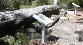
In 1910 the Western Australian Government set aside land in the Walpole area as a national park, which was the spark for a small but thriving tourism industry that continues to this day. (Other industries have come and gone, including whaling and sealing!)
Permanent settlement also commenced in 1910 when Frenchman Pierre Bellanger and his family took up land beside the Frankland River. The next year an English family, the Thompsons, settled at Deep River.
Initiated by then WA Premier Sir James Mitchell, Walpole and districts was opened up for agriculture through land settlement schemes in 1924, 1927 and 1930; to foster an agricultural community that would contribute to the rural economy of WA and create livelihoods for unemployed men and their families affected by the Great Depression.
In 1930, a year after the railway line reached Nornalup on the Frankland River, the Nornalup Reserves Board proposed the development of an area for holiday cottages 13 km downstream of the railway terminus, on the Nornalup and Walpole Inlets.
The decision to build a tourist town coincided with the 1930 farm settlement scheme during which applicants lived in a makeshift tent, tin and bush-pole shanty on what is now Walpole’s Pioneer Park. Under the scheme blocks of 120 acres (47.6 hectares) of forested land were allocated to each applicant by a ballot. Then began the hard work of clearing, fencing, building a home, and carving an existence from the land.
Meanwhile, in 1932, a site nearby the pioneers’ campsite on the northern shores of Walpole Inlet was selected for the holiday houses, lots for which were surveyed in 1933.
When the townsite was gazetted in 1933 the preferred name “Walpole” was rejected in favour of “Nornalup” as it was believed “Walpole” had already been used in Tasmania. Confusion was nevertheless inevitable as Nornalup was already associated with the railway terminus on the Frankland River 13 km to the east. A number of alternative names were considered before the Post Office confirmed in 1934 that there was no Walpole in Tasmania and thus the township was renamed.
Infertile land, indomitable forests, lack of farming skills, and the hardship of the 1930s depression beset the farm settlement schemes. Of the 100 farm blocks balloted, only 85 were settled, and less than a third of the original families stayed on.
Fortunately the stunning natural beauty and mild climate of Walpole & Districts continues to draw holiday makers, tourists, and travellers from WA and beyond, especially in the height of summer when the population of the town swells two-, three-, four- or more-fold.
Discover Walpole & Districts through the lens of our people in the following series of articles: